
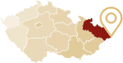
Easternmost point in the Czech Republic
In Bukovec
Many people think that the easternmost village in the Czech Republic is Hrčava and the easternmost point is the nearby triple boundary. Not so! Most eastward are last houses of the Bukovec village. In Bukovec, on the border with Poland, it is also located the easternmost point of the Czech Republic. Find out the exact coordinates of that point requires a little secret mission.
Easternmost point for us is not usually marked on tourist maps or is not highlighted nature trail which leads to it. Moreover, a cartographic publisher did not record it into their products.
We invite you to the easternmost point of the Czech Republic in the Silesian Beskids. The trip is ideal to combine with a visit to an earthy Hrčava triple boundary - Czech, Poland, and Slovakia. A landscape dotted with hamlets, mountain fields, and grazing sheep welcome you. Moreover, from the neighboring Poland, you may feel an even fresh whiff of the exotic East, which extends here along with the ridges of the Carpathian Mountains.
Hidden, East Point
The easternmost point will pleasantly surprise you. It is hidden in the dense spruce forest on the banks of the Olecki creek. A footpath which leads to the point is bestrewed with sawdust. There is silence, tranquility, and special spirited atmosphere.
From triple-boundary in Hrčava, you can get here either back along the yellow and then on the green trail or a slightly shorter route through the Polish village Javorzynka via green and yellow marks. Who has good navigation skills, can arrive at the easternmost point from the Polish side through the yellow tourist routes leading to the village Jasnowice. This means that the way leads through the brushwood of about 100 m or you can go across the rocky creek. It takes up to 2 hours from triple-boundary.
Notice board for nature trails will present you by a beautiful way a surrounding region. Especially you can see the life and character of local Goral and Olecka nature reserve, protecting rarely preserved peat meadows with orchids. Along these boards, you can return from the Czech "Eastermost Point" to the green marker trail.
From the easternmost point leads return track to Bukovec, either around the border crossing via green trail and then via unlabeled dirt roads around the Swedish fortifications where are the historical remains of fortifications from the Thirty Years War.
You can also visit a small museum in the building of the Polish school.
Easternmost point of the Czech Republic
Located in the village Bukovec and is characterized by the following geographical coordinates:49° 33´ 02.10521“N (latitude)
18° 51´ 33.31399“ E (longitude)
Recommended route
Mosty u Jablunkova - Gírová (red), 4 km - Hrčava (red, green, yellow), 10 km - Trojmezí (yellow), 12 km - Jaworzynka (green), 13 km - Bukovec, peat bogs (yellow, green), 17,5 km - the easternmost point of the Czech Republic (trail), 18 km - Bukovec (unsigned), 21 km.
Map
1: 50,000 KCT no. 97 - Silesian Beskidy Mountains and Jablunkov
Helpful links
Girova Cottage: www.chatagirova.cz
Jablunkov region: www.jablunkovsko.cz
Last updated on: 24. 5. 2017 11:41